3 routes of mountain climbing | Model Courses | Miyajima Tourist Association


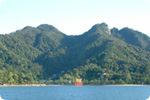
When the Seto Inland Sea came up about 6,000 years ago, Itsukushima (Miyajima) Island was separated with the opposite bank and became an island. The highest peak of Itsukushima is Mt. Misen at 535m, Komagabayashi at 506m and Mt. Iwafunedake at 466.6m.
People have felt divine power since the ancient times, and the whole island was an object of their faith. For 593 years, the God of Itsukushima enshrined in Itsukushima. It became an object of mountains religion in the Heian era, and Sanki Daigongen was worshiped in Mt. Misen. Kobo Daishi (Kukai) opened Mt. Misen for Shingon vajrayana in 806 and became its ashram.
In the Edo era, people climbed Mt. Misen for their faith and made a tour in Nanaura as parts of Itsukushima pilgrimage. Duke Hirobumi Ito, the first Prime Minister in the Meiji era, had strong faith in the Misen religion and made his effort for repair of the approach to Mt. Misen in 1906. There is its monument at the start point of the mount climbing route of Daishoin. In December 1996, Itsukushima Shrine, including the sea frontal and 431.2ha of the Mt. Misen primeval forest (national natural treasure) on the back, was registered as the world's cultural heritage.
It was selected in "New Japanese Top 100 Mountains" that Motoo Iwasaki, mountaineer, released in 2004, too.
It is simple for trekking, but it turns to a dangerous mountain because of its steepness, if you lose your way.
The following 3 safe routes are available.
Attention
- In Miyajima, you start from 0 m above see level. Even if it seems small for mountains, please do not underestimate them.
- Since the mountains are steep, there are searches every year for missing mountaineers.
- Please enjoy mountain climbing with the safe routes.
- Please climb the mountains with clothes and the shoes which are suitable to hike.
- Please take precautions against the cold in the winter and autumn.
- Please take safe paths in reference to guidance maps.
Also please carry compasses and a map issued by Kokudo Chiriin (the Geographical Survey Institute) just in case you might get lost. - Please keep hydrated.
- Please be careful of poisonous insects (hornets and others) and venomous snakes (vipers).
- Please make sure to take garbage home with you by each person.
- Collection and carry-on of plants are strict prohibited.
- Tour times indicated are just for reference. Actual tour time depends on individual difference. Please make a reasonable tour.
*For historic spots around the mountaintop, see Mt. Misen of sightseeing spots.
Daishoin Course
1h30 - 2h with a lot of stone steps
Front of Niomon Gate of Daishoin Temple. The start point of the route of the climb is on the left before the bridge.
On the route of the climb Daishoin Temple, there are "Choseki (guide stone)". 1 cho = 109 m, and 24 cho (about 2.6 km) to the peak. The view on the way is very good. There is a guardian deity for children and prayer rooms on the way, which show the faith for this mountain.
- Start point
- 5min.
- Miyuki stone, Shiraito Falls
- 15min.
- Satomichaya observatory
- 20min.
- Sai no Kawara
- 10min.
- Maku-iwa Rock
- Niomon Gate
- 21min.
- Misenhondo Hall, Reikado Hall
- Top of Mt. Misen
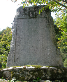
Monument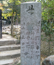
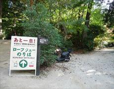
Start point of the route of the climb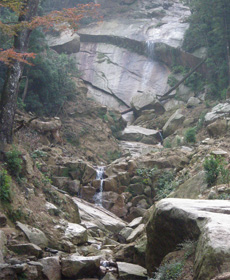
Miyuki stone and Shiraito Falls
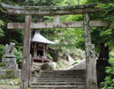
Torii gate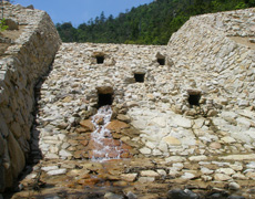
1st dam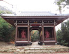
Niomon Gate
Momijidani Course
Around 1h30 with sloping road.
It is a mountain trail to climb in a forest.
- Oku Momijidani Bridge
- 1min.
- Start point
- 60min.
- Turning point
- 20min.
- Misenhondo Hall, Reikado Hall
- Top of Mt.Misen
Turning point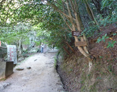
Start point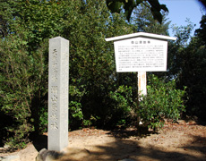
Turning point
Omoto Course
Around 2h with sloping road and stone steps
Please do not make a mistake in the start point of the route of the climb, because several accidents have occurred recently.
On the way, you can go to Komagabayashi from the turning point, but please watch your step on the dangerous rocky stretch.
- Omoto Shrine
- 3min.
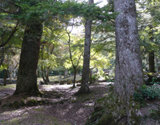
- Natural forest of fir trees
- 2min.
- Oku Omoto Park through Omoto River
- 45min.
- Kaze-fuki-iwa Rock
- 20min.
- Iwaya Daishi(cave)
- 10min.
- Turning point
- 5min.
- Komagabayashi Woods
- 5min.
- Turning point
- 5min.
- Niomon Gate
- 10min.
- Misenhondo Hall, Reikado Hall
Natural forest of fir trees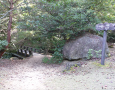
Oku Omoto Park through Omoto River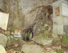
Kaze-fuki-iwa Rock
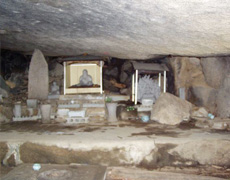
Iwaya Daishi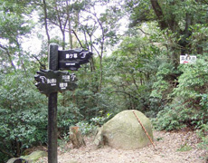
Turning point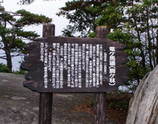
Komagabayashi Woods